
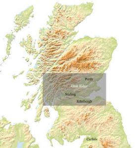
The Gask Ridge at around 70 metres above sea level lies between the Highland massif and Fife, and forms part of a corridor northwards towards the coastal strip of richer agricultural land that extends to the Moray Firth. The Ridge forms the core of the Gask Project’s Research Area.
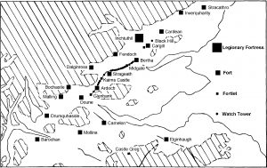
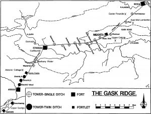
The maps show sites of Flavian age in the research area.
Detail maps
All Scotland (copyright Peter Green)
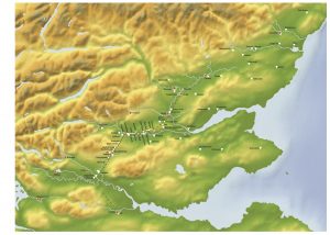
Flavian Scotland north of Newstead (copyright David Woolliscroft)
Gask Ridge (copyright David Woolliscroft)
Mid Scotland
Gask South – map 1
Gask South Central – map 2
Gask North Central – map 3
Gask North – map 4
To see more details: large_gask_map1
Discover more from The Roman Gask Project
Subscribe to get the latest posts sent to your email.